Drone roof inspection report Tillerman Logistics distribution centre, Ridgeway Industrial Estate |
| Client | Tillerman Logistics Ltd |
| Site | Tillerman Logistics, Unit 3 Ridgeway Industrial Estate, Kiln Lane, Marlbury |
| Reference | RK-2026-0433 |
| Survey date | 26 Mar 2026 |
| Remote pilot | Marcus Feld |
| Prepared by | Marcus Feld |
| Red: 4 | Amber: 4 | Green: 1 |
Sample report
| Drone roof inspection report | RK-2026-0433 |
Document control
Status code: S2
| Revision | Date | Status | Description | Author | Checked | Approved |
|---|---|---|---|---|---|---|
| P01 | 28 Mar 2026 | Draft | Draft for internal check | MF | EW | |
| A | 31 Mar 2026 | Issued | First issue to client | MF | EW | EW |
Distribution
| Name | Organisation | Copies |
|---|---|---|
| Tillerman Logistics Ltd | Tillerman Logistics Ltd | 1 |
This report has been prepared for the client named on the cover and may not be relied upon by any other party without the written agreement of Report Kit 360. The issue table above records every revision; the latest row is the current issue.
| Drone roof inspection report | RK-2026-0433 |
| Drone roof inspection report | RK-2026-0433 |
1 Executive summary
The roofs of the 9,400 m² distribution centre were surveyed by drone on 26 March 2026. The main warehouse roof (built-up metal with GRP roof-lights) is in fair condition for its 14 years; the office block's flat roof shows persistent ponding. 23 items were recorded: 3 red, 11 amber and 9 green. The red items are a displaced ridge capping at gridline 7 (risk of water ingress and wind damage), a blocked valley gutter outlet above the loading bay and a cracked roof-light sheet that is fragile. These should be dealt with within one month; the amber items can be programmed into the next maintenance window.
| Drone roof inspection report | RK-2026-0433 |
2 Site and asset details
Site
| Site address | Tillerman Logistics, Unit 3 Ridgeway Industrial Estate, Kiln Lane, Marlbury | Postcode | MB8 2VK |
|---|---|---|---|
| Asset surveyed | Main warehouse roof, office block flat roof and loading canopy | Asset type / construction | Built-up metal roof with GRP roof-lights; single-ply membrane flat roof |
| Approximate area or extent | 9,400 m² | Client contact | Gareth Pell |
Figure 2.1 — Site location / overview
| Drone roof inspection report | RK-2026-0433 |
3 Methodology
Flight and capture
| Aircraft (make / model) | DJI Mavic 3 Enterprise | Sensor(s) | 20 MP 4/3 CMOS, 24 mm equivalent |
|---|---|---|---|
| Ground sample distance (cm/px) | 1.4 | Flight altitude (m AGL) | 45 |
| Image overlap (front / side) | 80% / 70% | Ground control points | RTK positioning; 4 check points |
| Coordinate reference system | OSGB36 / British National Grid (EPSG:27700) | Survey date and time | 26 Mar 2026 |
| Weather | Dry, 7 °C, wind 4 m/s westerly, visibility over 10 km |
The survey was flown as a series of planned and manual flights to capture oblique and nadir imagery of the asset. Images were reviewed by the surveyor named on the cover; observations were rated using the scheme printed in this report.
Flights were flown as planned. Imagery was processed in Pix4Dmatic 1.60 to produce a 1.4 cm/px orthomosaic and a digital surface model; the point cloud and 3D model are supplied with the raw imagery. No thermal capture was made on this visit.
Imagery captured by unmanned aircraft shows the external surfaces visible from the air at the time of the flight. It cannot confirm the structural capacity of any element, the composition of materials, the condition of concealed layers or substrates, or whether an area can be accessed safely for works. Where an area was not captured (for example because of weather, airspace limits, obstructions or glare) this is stated in the coverage section.
| Drone roof inspection report | RK-2026-0433 |
4 Compliance evidence
Operator and authorisation
| Operator ID | GBR-OP-EXAMPLE1234 | Operational authorisation / GVC reference | OA-EX-2041 (GVC) |
|---|---|---|---|
| Remote pilot name | Marcus Feld | Flyer ID | FLY-EX-204871 |
| Insurance (policy / expiry) | Policy EX-UAS-77812, expires 2026-11-30 | Site-specific risk assessment reference | RA-TL-2026-03 |
| Airspace / NOTAM check | Checked on NATS drone assist; no NOTAMs | Landowner / occupier permission | Written permission from Tillerman Logistics Ltd |
Table 4.1 — Flight log (retain for at least three years)
| Date | Take-off / landing | Start | Duration | Day / night | Aircraft make / model / serial | Remote pilot | Occurrences |
|---|---|---|---|---|---|---|---|
| 2026-03-26 | Yard, north-west corner | 09:40 | 18 min | Day | DJI Mavic 3 Enterprise | Marcus Feld | None |
Pre-flight checks
| Item | Result | Note |
|---|---|---|
| Weather within limits | ✔ Pass | |
| Airspace and NOTAMs checked | ✔ Pass | |
| Site risk assessment reviewed | ✔ Pass | |
| Aircraft pre-flight inspection completed | ✔ Pass | |
| Batteries and firmware checked | ✔ Pass | |
| Emergency procedures briefed | ✔ Pass |
| Drone roof inspection report | RK-2026-0433 |
5 Extent of coverage
All roof areas were captured at nadir and at 45° obliques. The 3 m strip along the eastern boundary was flown at reduced height because of the adjacent overhead line; the gutter detail there is from obliques only. No areas were excluded.
Figure 5.1 — Coverage plan
| Drone roof inspection report | RK-2026-0433 |
Rating guide
| Drone roof inspection report | RK-2026-0433 |
6 Defect register
| Ref | Element | Location | Condition / description | Rating | Photo | Measurement | Recommended action | Timescale |
|---|---|---|---|---|---|---|---|---|
| 1 | Ridge capping | Gridline 7, main roof | Capping displaced 300 mm; fixings missing. | Red | 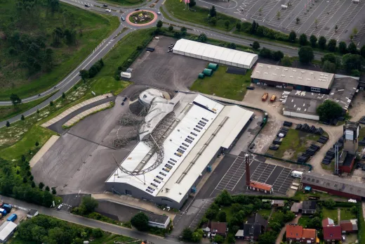 | Refix with new stitching screws; check adjacent cappings | Within 1 month | |
| 2 | Valley gutter outlet | Above loading bay | Outlet blocked with debris; water standing 60 mm deep. | Red | 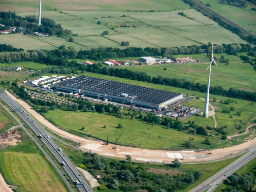 | Clear and fit leaf guards | Within 1 month | |
| 3 | Roof-light | Bay 12 | Outer GRP sheet cracked; fragile. | Red | 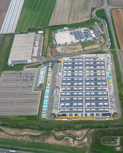 | Replace; fit fragile-roof signage | Within 1 month | |
| 4 | Sheet cut edges | Eaves, south slope | Cut-edge corrosion along about 40 m of eaves. | Amber | Prepare and treat with a cut-edge coating | Next maintenance window | ||
| 5 | Flat roof | Office block | Ponding over about 30% of the area; membrane sound. | Amber | Monitor; consider additional outlets | 12 months | ||
| 6 | Gutter joints | North eaves gutter | Three joints weeping; staining on the cladding below. | Amber | Reseal the joints | Next maintenance window | ||
| 7 | Canopy | Loading canopy | Light moss growth; otherwise sound. | Green | Clean at the next maintenance visit | Routine |
Measurements are taken from the photogrammetric model where stated and are approximate.
| Drone roof inspection report | RK-2026-0433 |
7 Photograph
Photograph 1 — Ridge capping at gridline 7 (Main roof)
| # | Rating | Detail | Fault type | Tags |
|---|---|---|---|---|
| #1 | Red | Displaced capping | Wind damage Fixings issue | |
Defect: ridge capping displaced about 300 mm with missing fixings. Risk: water ingress and further wind damage; the loose capping could fall. Recommendation: refix with new stitching screws and check the remaining cappings within one month. | ||||
| #2 | Amber | Cut-edge corrosion | Cut end corrosion | |
Edge corrosion to the adjacent sheet; treat with a cut-edge coating in the next maintenance window. | ||||
| Drone roof inspection report | RK-2026-0433 |
8 Recommendations
1. Refix the ridge capping at gridline 7 and check the remaining cappings (roofing contractor, within one month). 2. Clear the valley gutter outlets and fit leaf guards (within one month). 3. Replace the cracked roof-light and fit fragile-roof signage at the access ladder (within one month). 4. Programme the amber items (sealant renewal, cut-edge corrosion treatment, gutter joint repairs) for the summer maintenance window. 5. Re-survey in 24 months or after any storm event.
The findings describe the condition observed on the inspection date. Buildings and assets change with time, weather and use; if a decision is to be made more than three months after the inspection date we recommend that the relevant areas are re-inspected.
| Drone roof inspection report | RK-2026-0433 |
Appendix A — Raw data manifest
| Deliverable | Format | Files / size | Location / link |
|---|---|---|---|
| Raw imagery | JPEG | 612 | Project share, folder 01_raw |
| Orthomosaic | GeoTIFF | 1 | Folder 02_ortho |
| Point cloud | LAS / LAZ | 1 | Folder 03_cloud |
| 3D model | OBJ | 1 | Folder 04_model |
| Flight logs | CSV | 3 | Folder 05_logs |
| Drone roof inspection report | RK-2026-0433 |
Appendix B — Weather record
Conditions at time of flight
| Wind speed / gusts | 4 m/s, gusts 6 m/s | Direction | West |
|---|---|---|---|
| Precipitation | None | Visibility | Over 10 km |
| Temperature | 7 °C | Source | Met Office observation, Marlbury, 09:00 |
| Drone roof inspection report | RK-2026-0433 |
Declaration
I confirm the flights were conducted in accordance with the operator's operations manual and the authorisations stated, and that the observations represent my professional opinion of the condition visible at the time.
Prepared by Marcus Feld Report Kit 360 Date: 31 Mar 2026 | Checked by Eleanor Whitcombe Report Kit 360 Date: 31 Mar 2026 |